Hidden induced polarization in public Earth MRI airborne EM
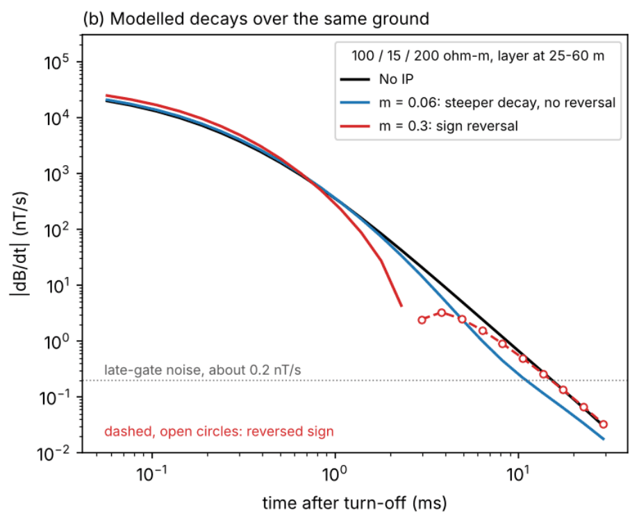
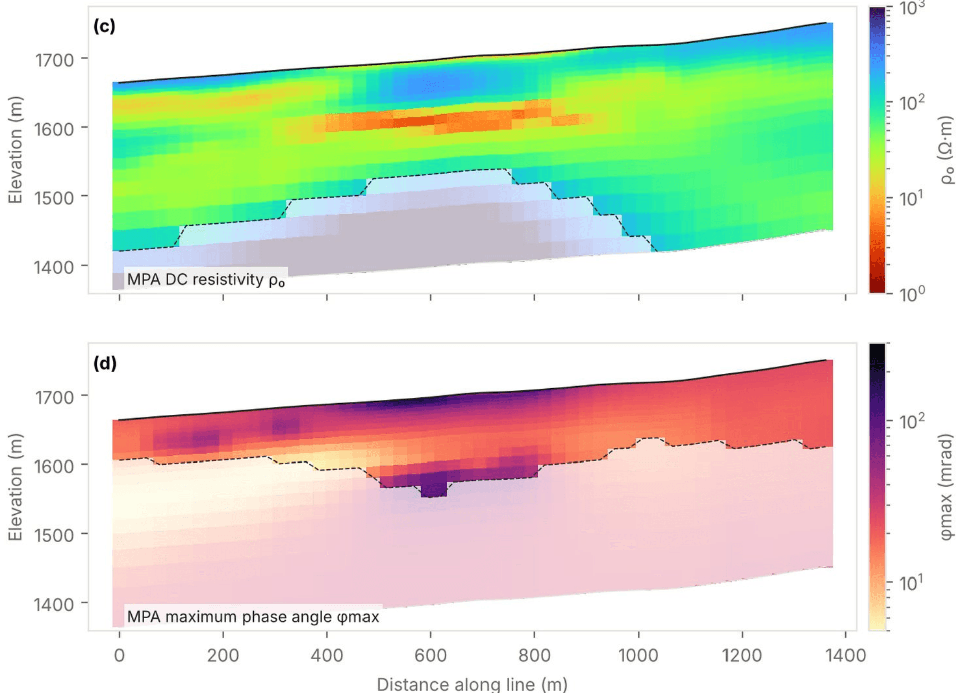
Regional airborne EM surveys are inverted for resistivity only, and soundings that a layered model cannot fit are down-weighted or removed. We re-inverted the public USGS Earth MRI Basin and Range survey of Nevada and California (2022 to 2023) with chargeability included. Some of those discarded soundings carry an induced polarization signal, the kind produced by disseminated sulfides, graphite and clay-rich ground.
- 216,137public soundings scanned
- 488with a consistent IP signature
- 40segments across three survey systems
- 0new survey flights needed
Raw-data inversions confirm chargeable layers at roughly 40 to 130 m depth on several lines, including a place where two flight lines flown at right angles recover matching chargeability, resistivity and depth. The scan uses only quantities USGS already publishes, so it can screen any Earth MRI airborne EM release for chargeable ground.
Target locations are shared with clients in regional briefs rather than published here.